by Gene Marrano
There are now more than six miles of walking trails at Roanoke County’s Read Mountain Preserve on the Roanoke County/Botetourt County line in the Bonsack area. That’s the word from Ron Crawford, founder of the Read Mountain Alliance, a loosely organized group of local stakeholders that have worked with Roanoke County, the Western Virginia Land Trust and several land donors to preserve the ridgeline of Read Mountain.
While the four mile round trip hike to the top of Buzzard’s Rock has been open for about two years, another as-of-yet unnamed section that made its debut last month now means that hikers can take a round trip via alternate routes on Read Mountain before or after the climb to Buzzard’s Rock. The new 1.75-mile (approx.) trail, built by the volunteer group Pathfinders for Greenways, connects to an old path that was built by the Conservation Civilian Corps in the 1930’s, accessible off the Buzzard’s Rock trail.
“I call it the Rocky Way Trail,” said Crawford, who greeted hikers at the trailhead off Crumpacker Road last week, showing them the new options they had for hikes. He will present a finished map to Roanoke County’s Parks & Recreation department, which will officially name it. Retired physician Bill Gordge and other Pathfinders started work on the Rocky Way Trail about a year ago, according to Crawford, a retired architect and one of the partners at SFCS.
“They’re a phenomenal group of people,” said Crawford of the Pathfinders that put in more than 700 man-days to build Rocky Way Trail. He calls it “one of the most beautiful trails in the Roanoke Valley.” It helps now create several loops in fact, with the help of a crossover path that features an outcropping called The Fortress.
“When I first saw it I was reminded of Mount Rushmore,” said Crawford, “just an incredible space to be in.” He also calls it a natural amphitheater and can envision music or nature programs there some day. That’s also where one part of a trail, hewn into 73 stone steps, is called “Jacob’s Ladder.”
Future plans call for improving several other unmarked paths. Crawford received permission from Roanoke County to mark the new trail as it veers from the Buzzard’s Rock path. “It was probably the ‘ruggedest’ area to go through [for a trail],” noted Crawford. Monkey’s Head, Cascade Rocks and Devil’s Drop are featured stops named along the new footpath. Devil’s Drop features “a tremendous view,” looking south towards the Roanoke Valley, according to Crawford.
There are big plans for trails in the Read Mountain Preserve, which will ultimately be connected to the Tinker Creek Greenway and thus (indirectly) the Roanoke River Greenway, Carvins Cove and even the Appalachian Trail. That would involve an initial connection through another piece of adjoining property that must still be purchased or leased.
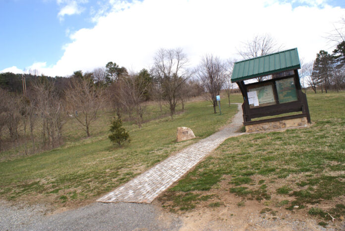
A conservation easement that allows for tax breaks while retaining ownership is also a possibility. Easements and donations of land from Dr. Al Durham and Fralin & Waldron helped create the 258-acre preserve. A grant from Roanoke County helped fund the parking area, information kiosk and trailhead in the Orchard Hills subdivision in Bonsack.
The principal access to Read Mountain used to be from Crawford’s property in adjoining Botetourt County. “I think there’s hundreds of people going through every week,” said Crawford, “they’re from all over the place.” Those trails may get busier now that the Rocky Way Trail provides for more looping round trip possibilities. “We can’t improve on the mountain,” noted Crawford, “but we can make it more accessible so that people can enjoy it.”


I very much enjoy the Buzzard’s Rock trail and the new trail built by Mr. Crawford and his workers. I live in Orchard Hills and frequently run up Read Mountain. As a matter of fact, I spent roughly 5 hours on that mountain today, 4 hiking/exploring and 1 running. I very much enjoy the pleasure that trail running brings me. I was wondering, when these new trails that connect to the Tinker Creek Greenway, Carvins Cove, and the AT might be constructed? I love running and would be more than willing to help construct these new trails. Also, I was curious if anyone had any maps of the mountain showing all the trails known to exist? This would be very helpful. Thank you.
I agree with needing a map of new trails. Me and my kids hiked this for the first time today. We did’t take any of the new trails because we were unsure where they came out and difficulty. Loved the old trail tremendously .