The transformation of the Missouri Boot Heel
Somewhere Kevin Kelly published a list of things a person should know to be well-grounded and place-aware. Maybe top of the list was to know where your water comes from, and where it goes. (If I find that list, I will add it here later. It is a good guide to personal environmental awareness that too many Americans lack.)
I already know that Columbia’s water is drawn from deep deposits of glacial rock and gravel deposited along the wide Missouri. But I didn’t know so much about the river at large, save that Lewis and Clark had traveled it.
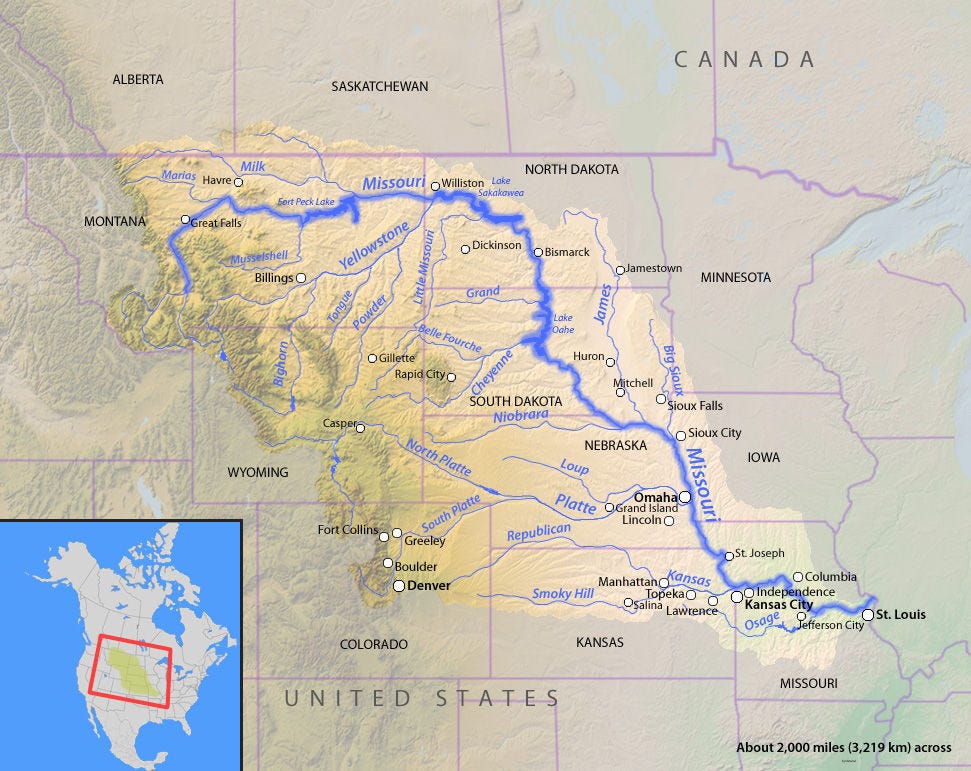
So a few weeks back, I explored the full reach of the Missouri River (the longest river in the US), which forms the south-west border of Boone County, Missouri.

If It Can Be Done: The Corps of Engineers
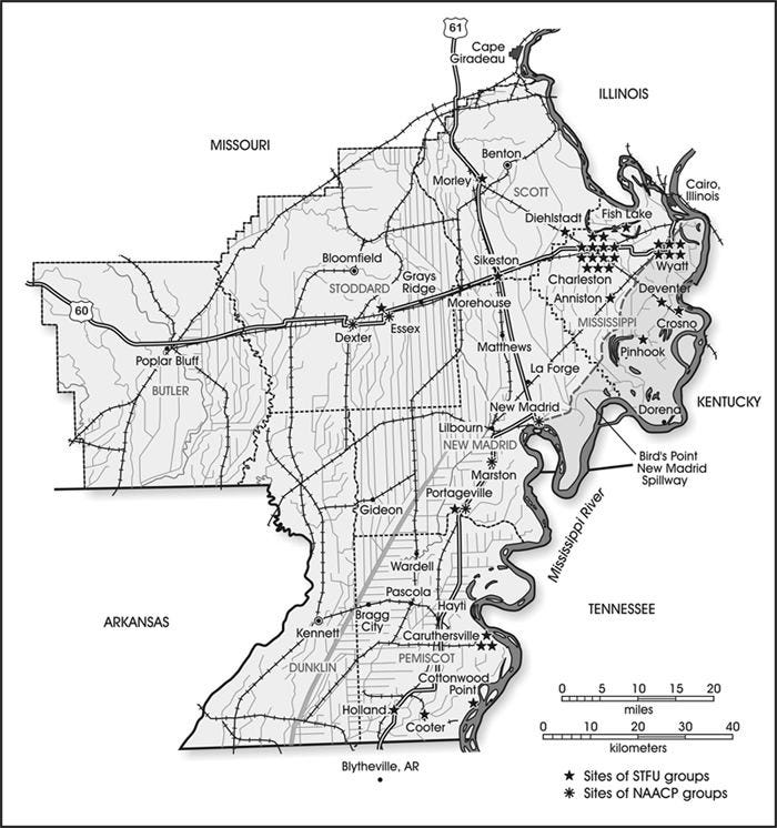
Zooming in on one particular river map, a number of oddly straight and parallel, man-made lines that were tens of miles long penetrated into the Missouri “boot heel” near New Madrid. There had to be an engineering story to explain this. It was more interesting than I had imagined.

By means of these canals, 500,000 acres of the Mississippi River’s ancient wandering floodplain was converted into fertile, well-watered farmland.
The Little River Drainage Project dredged and moved more land than the Panama Canal, using massive machines that had been invented and employed for that work. Ultimately over decades, that work created some of the most productive cropland in the country.
On our trip home from Missouri years ago, we drove through this region without knowing what to expect. For more than an hour, were surrounded in every direction by mostly cotton fields as far as the eye could see, but also soybeans and corn. It was the flattest country I had ever seen. It had once been a cypress swamp, its transformation the result of human terraforming of massive proportions.
The 15 minute documentary video below by The History Guy offers a full account of the project. As I watched it, imagining the before and seeing the after, I regretted that it had been deemed necessary to obliterate a massive natural landscape to feed a swelling human population that knew and still knows no limits to its wants and needs, at great cost to the dwindling storehouse of Nature.
“If it CAN be done, it SHOULD be done.”
A mandate said to describe the Corps of Engineers
Postage-stamp demonstration plots of Big Cypress persist in the boot heel; and likewise, a few tiny remnants of prairie that used to cover a third of the state can still be found—another victim of Big Ag. I hope to visit both. More on prairies in another post.
 – Fred First is an author, naturalist, photographer watching Nature under siege since the first Earth Day. Cautiously hopeful. Writing to think it through. Thanks for joining me. Subscribe to My Substack HERE