

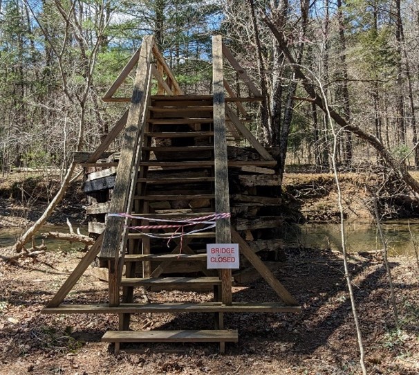
The George Washington and Jefferson National Forest is closing the Craig Creek bridge on the Appalachian National Scenic Trail for public safety. The footbridge that crosses Craig Creek, in the Brush Mountain Wilderness in Craig County, Va., is closed to all use indefinitely. Hikers should not use the existing bridge and should follow directions from posted signs. Appalachian Trail hikers can walk through Craig Creek within 100 yards of the bridge, utilizing a temporary detour. Creek crossing may be impassable or unsafe during high water. During high water events, hikers should wait for water levels to recede or utilize road detours. Hikers are advised to plan accordingly.
 For hikers heading northbound on the Appalachian Trail (A.T.): At the Craig Creek Rd/VA 621 road crossing, take a left and follow Craig Creek Rd for approximately 3.3. miles to the intersection with Miller Cove Rd/VA 620. Turn right and follow Miller Cove Rd for approximately 1.2 miles to the A.T. crossing. Turn left off of the road and follow the A.T. where it continues north across Trout Creek via a footbridge. For hikers heading southbound on the A.T.: At the Miller Cove/VA 620 road crossing, take a right and follow Miller Cove Rd for approximately 1.2 miles to the intersection with Craig Creek Rd/VA 621. Turn left and follow Craig Creek Rd for approximately 3.3 miles to the A.T. crossing (look for a small dirt lot on the right side of the road). Turn left off of the road and follow the A.T. south toward Niday Shelter.
Plans to remove and replace this bridge are ongoing.
